The temperature in the environment increases at a rate of 11 degrees Celsius per kilometer. This environment
A) is absolutely stable.
B) is absolutely unstable.
C) has a neutral stability.
D) cannot be assessed for stability without more information.
E) is conditionally unstable.
A
You might also like to view...
What is the relief (elevation difference between the highest and lowest points, in a local landscape) in the river valley along southwest slopes? Along the northeast slopes?
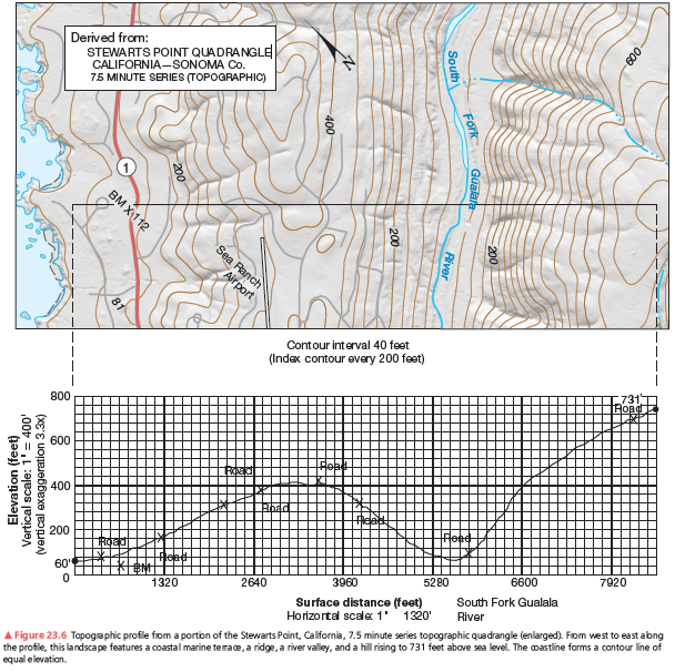
A second example of a vertical profile is in Figure 23.6. Using the same procedure as you did on the previous assignment, construct a topographic profile. Label the South Fork of the Gualala River (see Figure 23.4, Step 3), the bench mark at 112 feet, and various road crossings on your profile. The coastline forms a contour line of equal elevation—sea level. Note the change in contour interval and scale from that of Figure 23.5. Use Figure 23.6 to answer further questions about preparing a topographic profile.


The first major transgression onto the North American continent is recorded in rocks of the
_______ Sequence. Fill in the blank(s) with the appropriate word(s).
The major rivers in the U.S., including the Colorado and Rio Grande, originate in mountainous regions with significant contributions from snow melt and then cross arid regions before supplying the water needs for several cities in the U.S
and Mexico. Discuss the potential impact of climate change on the water supplies.
Aside from limestone, which other kinds of rock types produce karst terrain?
A. shale B. sandstone C. evaporite rocks such as salt and gypsum D. granite