The Crusades were a series of European military campaigns to assume control of
A) the Arabian Peninsula.
B) the Mediterranean trade.
C) the Holy Land.
D) Europe.
E) the Nile.
Answer: C
You might also like to view...
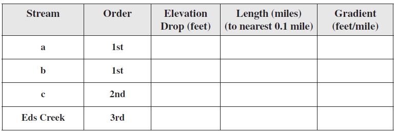
Using Map T-3, determine the gradients of the two first-order streams labeled “a” and “b” on the map above, the second-order stream labeled “c” on the map above, as well as Eds Creek after it has become a third-order stream. Determine stream length to the nearest 0.1 mile (take your measurements from Map T-3, not the small map above) using the graphic scale provided.
The following questions are based on Map T-3, the “Deer Peak, Montana” quadrangle (scale 1:24,000; contour interval 40 feet), and Figure 39-3, a stereogram of the same area showing the drainage basin of Eds Creek (46°54'26"N, 114°31'02"W).

The congressional districts of Iowa display
A) "wasted vote" gerrymandering. B) no gerrymandering. C) "stacked vote" gerrymandering. D) "excess vote" gerrymandering.
Development analysts expect that a more developed country will have a
A) low GII and a low HDI. B) low GII and a high HDI. C) high GII and low HDI. D) high GII and a high HDI. E) low HDI.
What are some of the problems with an isostatic model of crustal elevations that relies on wood blocks floating in water as an analogy?
What will be an ideal response?