The weight of ice atop a continent can depress the depth of the shelf break
Indicate whether the statement is true or false
True
You might also like to view...
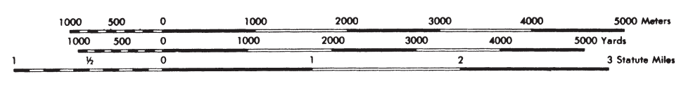
Why isn’t “0” at the far left of the scales?
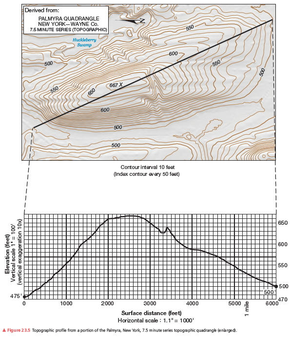
After you complete the topographic profile you’ll notice a marine terrace, a relatively flat platform or “shelf,” along the coast. You can find where the marine terrace ends by looking along the topographic profile for where the slope changes from flat to steeper. What contour elevation marks this change from the marine terrace to the hills inland? How wide is this terrace from the coast line to that contour line elevation in feet?
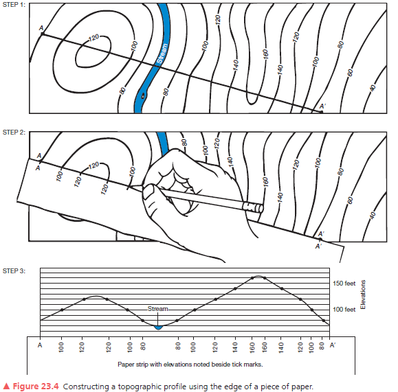
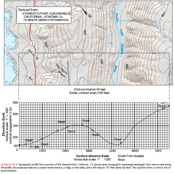
A second example of a vertical profile is in Figure 23.6. Using the same procedure as you did on the previous assignment, construct a topographic profile. Label the South Fork of the Gualala River (see Figure 23.4, Step 3), the bench mark at 112 feet, and various road crossings on your profile. The coastline forms a contour line of equal elevation—sea level. Note the change in contour interval and scale from that of Figure 23.5. Use Figure 23.6 to answer further questions about preparing a topographic profile.
The country with the highest rate of sustained economic growth between 1980 and 2000 is
A. Japan B. South Korea C. China D. The United States
Diurnal tides are more prevalent at middle latitudes when the tide-raising bodies are ________.
A. 180 degrees to each other B. 90 degrees to each other C. at high declination D. at low declination E. in line with each other