A map of population density for the Middle East is perhaps best understood in comparison to proximity to water, as settlements have historically developed around access to water in this dry environment
Indicate whether the statement is true or false
T
You might also like to view...
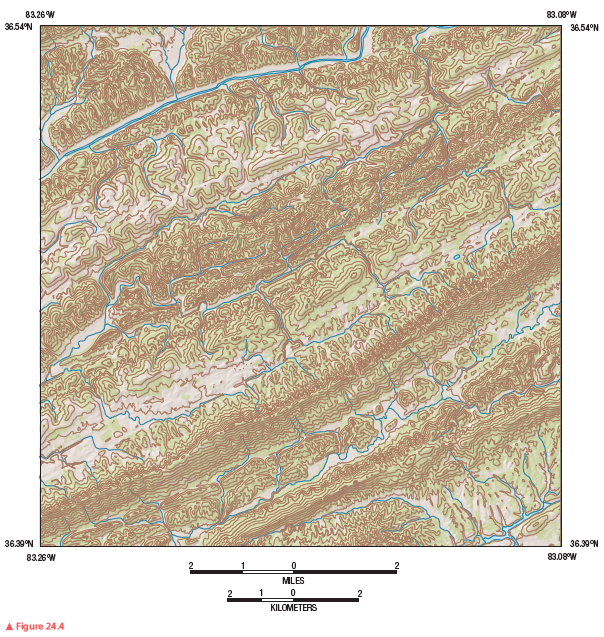
What is the contour interval on this map segment?
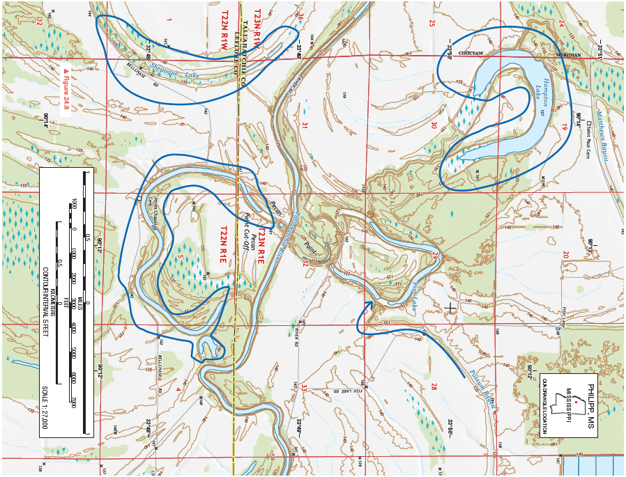
Figure 24.8 is a portion of the Philipp, Mississippi, 7.5-minute quadrangle in northwestern Mississippi. The Tallahatchie River flows through the landscape from west to east. (Remember to use the topographic map symbol legend inside the front cover of this manual.)
Review Figure 24.4, analyze Figure 24.8 closely, and answer the following questions and completion items about Figure 24.8.
Four of the following are benefits that coral reefs provide. Which one is the exception?
A. They provide significant free oxygen. B. They serve as natural barriers. C. They protect coastlines from erosion. D. They provide habitats for one-quarter of all marine organisms. E. They provide one-tenth of the global fish catch.
When studying climate, which of the following would be considered an example of the macro scale level?
a. New York City b. the Florida Keys c. the Amazon Basin d. the underside of a leaf
Which of the following is a failed rift that formed in North America over one billion years ago?
A) A Mid-Continent Rift B) East African Rift C) Chile Rise D) Kuril Trench