Patterned ground is found in the:
a. savanna
b. taiga
c. tundra
d. none of these
C
You might also like to view...
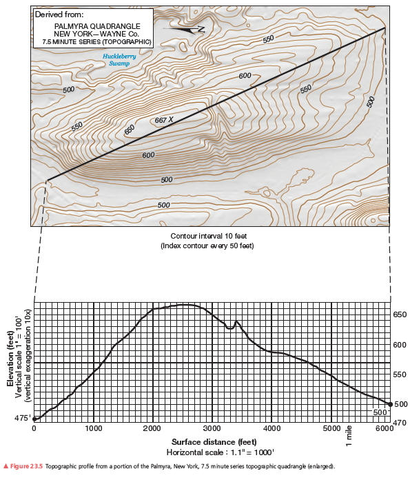
After you complete the topographic profile you’ll notice a marine terrace, a relatively flat platform or “shelf,” along the coast. You can find where the marine terrace ends by looking along the topographic profile for where the slope changes from flat to steeper. What contour elevation marks this change from the marine terrace to the hills inland? How wide is this terrace from the coast line to that contour line elevation in feet?
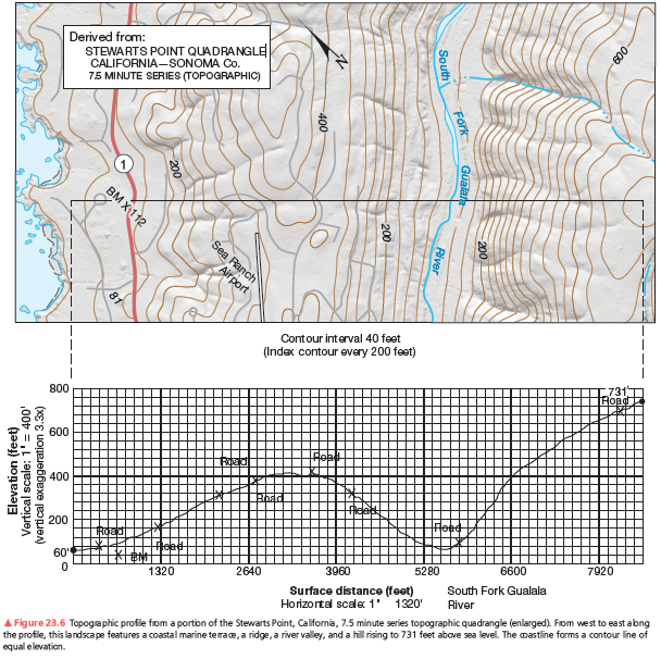
A second example of a vertical profile is in Figure 23.6. Using the same procedure as you did on the previous assignment, construct a topographic profile. Label the South Fork of the Gualala River (see Figure 23.4, Step 3), the bench mark at 112 feet, and various road crossings on your profile. The coastline forms a contour line of equal elevation—sea level. Note the change in contour interval and scale from that of Figure 23.5. Use Figure 23.6 to answer further questions about preparing a topographic profile.
A projectile fired vertically at 8 km/h from the Earth's surface will
A. rise and fall back to Earth's surface. B. go into an elliptical orbit about Earth. C. go into a circular orbit about Earth. D. none of the above
Waves often strike the shore at an angle, but the backwash is directly back into the water. The resulting zigzag movement of sand down the beach is called _________.
A. longshore drift B. wave refraction C. swashbucklers D. rip current E. barrier island
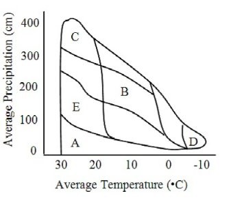 In the graph of precipitation and temperature, desert biomes would fall in the area marked by the letter:
A. A B. B C. C D. D E. E