Natural boundaries are deemed to be the best due to their consistency.
Answer the following statement true (T) or false (F)
False
You might also like to view...
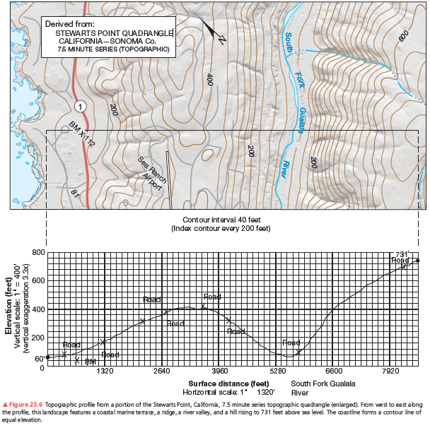
What is the relief (elevation difference between the highest and lowest points, in a local landscape) in the river valley along southwest slopes? Along the northeast slopes?
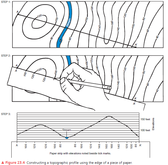
A second example of a vertical profile is in Figure 23.6. Using the same procedure as you did on the previous assignment, construct a topographic profile. Label the South Fork of the Gualala River (see Figure 23.4, Step 3), the bench mark at 112 feet, and various road crossings on your profile. The coastline forms a contour line of equal elevation—sea level. Note the change in contour interval and scale from that of Figure 23.5. Use Figure 23.6 to answer further questions about preparing a topographic profile.
____________________ landforms and processes are those associated with the work of the wind
Fill in the blank(s) with correct word
The silica rich oozes of the Pacific Ocean are due to ________ at high latitudes and ________ at low latitudes.
A. diatoms; diatoms B. diatoms; radiolarians C. radiolarians; diatoms D. radiolarians; radiolarians E. None of these are correct.
What best describes the basic way in which soils form?
A. physical and chemical weathering of rock B. breakdown of minerals by ultraviolet radiation C. erosion and deposition of sediment D. repeated flooding over long periods of time E. reactions between water and atmospheric oxygen