Over the course of a year, this would have the least cloud cover
A) equator.
B) 7 degrees north.
C) horse latitudes.
D) 40 degrees north.
E) 50 degrees north.
C
You might also like to view...
Which wind belt is located at letter D?
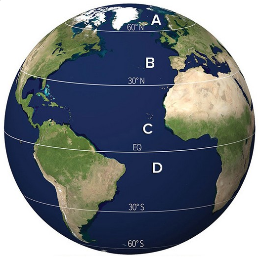
A) Polar Easterlies
B) Westerlies
C) Northeast Trade Winds
D) Southeast Trade Winds
Which of the following is a source of groundwater contamination?
A. ponds on the surface that store liquid waste. B. the use of fertilizer and pesticides. C. septic tanks. D. All of these are correct.
When vapor turns into liquid water it forms beads of ________
Fill in the blank(s) with correct word
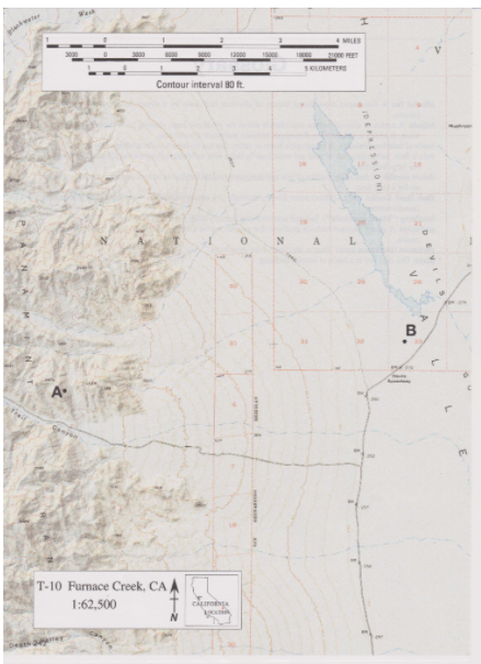
The following questions are based on Map T-10, the “Furnace Creek, California" quadrangle (scale 1:62,500; contour interval 80 feet; dotted lines represent 20-foot contours). This portion of the Furnace Creek quadrangle shows the Panamint Range and the western side of Death Valley in Death Valley National Park (36919'08"N, 116°53'25"W). Several large alluvial fans can be seen along the eastern front of the Panamint Range. The basin floor here is called the Death Valley "salt pan," because salts have accumulated here in great thicknesses. What is the local relief shown on the map?