The highlighted areas represent ________ climates
A) subarctic
B) polar
C) humid subtropical
D) severe midlatitude
Answer: D
You might also like to view...
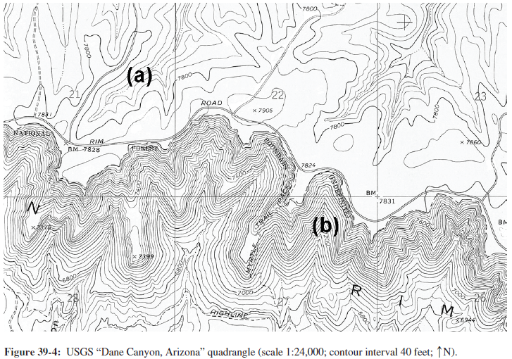
If gradient were the only factor controlling the erosive power of these streams, what should happen to the position of the mesa edge with time?
The following questions are based on Figure 39-4, a section of USGS “Dane Canyon, Arizona” quadrangle below, showing the southern edge of the Mogollon Mesa (34°24'33"N, 111°10'52"W), formed by a nearly flat-lying layer of resistant rock (you can view this map in color by going to the Lab Manual website or by scanning the QR code for this exercise).
The Kyoto Protocol is an international treaty with a goal of reducing major greenhouse gases
Indicate whether the statement is true or false
Which model of convection describes how the interior is divided into several levels of convection cells?
A) Layer cake model B) Whole-mantle convection C) Plume model D) Differentiation model
Cyclogenesis refers to the last stage of a midlatitude cyclone life cycle
Indicate whether the statement is true or false